Context of the study
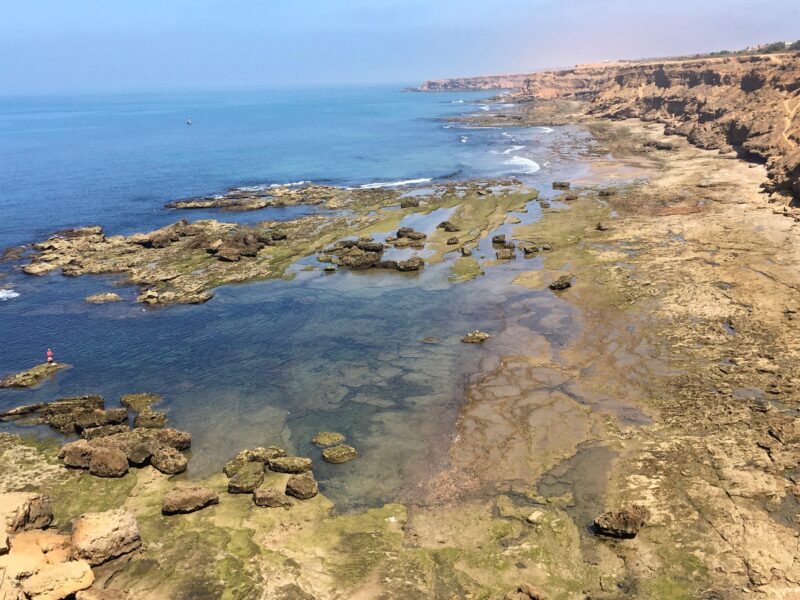
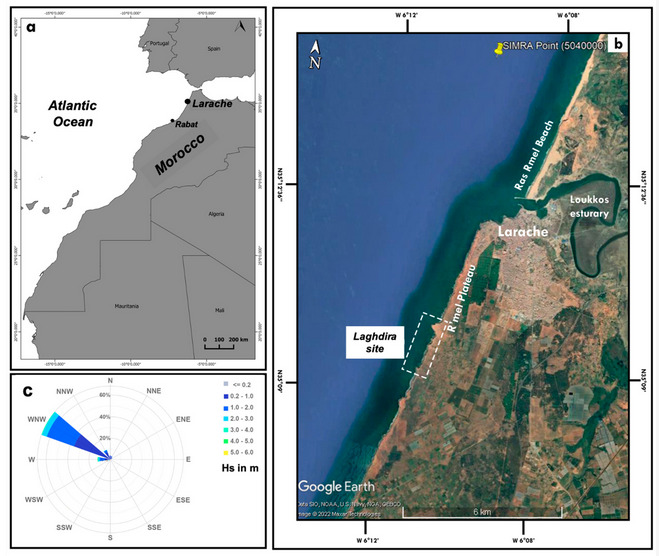
The Gof-boulders project : “Geomorphological control on offshore boulders transport along a wave dominated coast” is a project funded by ISblue and led by Mouncef Sedrati ( Geo-Ocean UMR CNRS 6538) for the monitoring of coastal dynamics and to better understand the morphological constraints and hydrodynamic conditions responsible for the distribution and dynamics of submerged (in the near subtidal zone) and emerged (on the rocky platform) boulders of the site of Laghdira in northwest Morocco.
This study involves the use of a drone and motion-based structure photogrammetry for the detection of boulder movement under the effect of storms.
Principle
The detachment and mobilization of boulders from rocky shelves by waves involves complex geomorphological and hydrodynamic processes.
To understand these processes, precise information is needed on the frequencies and modalities of movement of these megaclasts in relation to the wave conditions that generate boulder mobility.
Repetition photogrammetry and structure-from-motion (SfM) models commonly used in geomorphological analyses are an attractive option for monitoring boulder dynamics.
Method
In this study, drone-based digital photogrammetry and differential SfM models are used to identify recent boulder movements on a rock platform in Laghdira.
Combining these results with storm data from the study area identified storm waves as the sole driver of the dislodged and mobilized boulders.
The identified storm event had a significant wave height of 5.2 m. The drone models were constructed from imagery captured in September and December 2019 , and QGIS software was used to produce 2D and 3D model outputs. Exploitation of the 2D model differentials were used to assess the response of boulders to storm waves and to determine volumetric changes in the platform and, therefore, boulder mobility.
The impact of drone models
The 3D models were valuable in determining the mode of boulder transport. Mobility patterns included sliding, overturning without further mobility, rotation and saltation, and boulder breakup. Storm surge did not preferentially impact any particular boulder shape, size class, or position on the outer edge of the shelf. These results highlight the utility of combining drone surveys with identified storm events, which are much more frequent than tsunamis, to determine the movement and mobility of observed boulders.
For more information
This paper, “Using UAV and Structure-From-Motion Photogrammetry for the Detection of Boulder Movement by Storms on a Rocky Shore Platform in Laghdira, Northwest Morocco” Remote Sensing. 2022 presents the first results of the project and focuses on the use of UAV surveys and Structure-From-Motion (SfM) photogrammetry for the detection of boulder mobility following storm events.
 Attention, vous utilisez un navigateur peu sûr !